| FLIGHT DATA |
|---|
| DATE FLOWN |
2000 |
| SCALE |
1:4,800 |
| CALL NUMBER |
G4364.S5:2S3A4 2000 .W3 Case B |
| AREA COVERED |
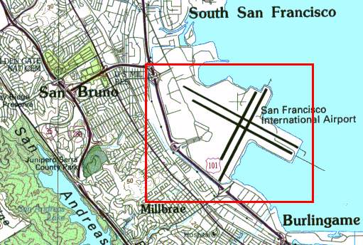
San Francisco International Airport
Click for Coverage Map
|
| FLOWN BY |
WAC Corp. |
| AGENCY FOR WHOM FLOWN |
WAC Corporation Inc. |
| FLIGHT ID SYMBOL |
WAC-C-00-CA |
|
| TYPE OF IMAGE |
| Vertical |
X |
| Oblique |
|
| Black & White |
|
| Natural Color |
X |
| Color Infra-Red |
|
| Stereo Overlap |
|
| Contact Print |
|
| Transparency |
|
| Oversize |
X |
| Digital / cd-rom |
|
|
![[ HELP/SEARCH ]](http://www.lib.berkeley.edu/Images/helpgr.gif)
![[ CATALOGS ]](http://www.lib.berkeley.edu/Images/catalogsgr.gif)
![[ COMMENTS ]](http://www.lib.berkeley.edu/Images/commentsgr.gif)
![[ HOME ]](http://www.lib.berkeley.edu/Images/homegr.gif)