| FLIGHT DATA |
|---|
| DATE FLOWN |
1941 |
| SCALE |
1:20,000 |
| CALL NUMBER |
Air Photo 4 |
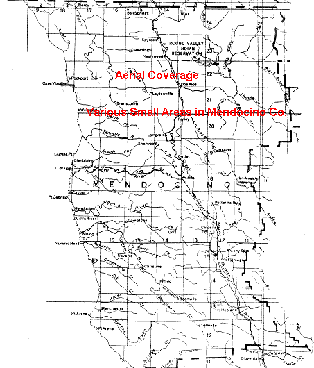
| AREA COVERED |
Mendocino County (part)
Click for Coverage Map
|
| FLOWN BY |
Aero Service Corp. |
| AGENCY FOR WHOM FLOWN |
USDA, Agricultural Adjustment Agency |
| FLIGHT ID SYMBOL |
CVN |
|
| TYPE OF IMAGE |
| Vertical |
X |
| Oblique |
|
| Black & White |
X |
| Natural Color |
|
| Color Infra-Red |
|
| Stereo Overlap |
X |
| Contact Print |
X |
| Transparency |
|
| Oversize |
|
| Digital / cd-rom |
|
|
![[ HELP/SEARCH ]](http://www.lib.berkeley.edu/Images/helpgr.gif)
![[ CATALOGS ]](http://www.lib.berkeley.edu/Images/catalogsgr.gif)
![[ COMMENTS ]](http://www.lib.berkeley.edu/Images/commentsgr.gif)
![[ HOME ]](http://www.lib.berkeley.edu/Images/homegr.gif)